


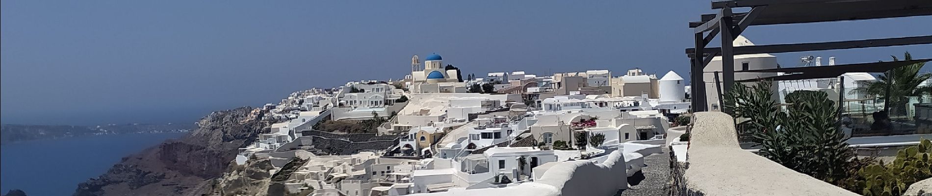
Balade Fira Ioa avec pique nique

Timax31
User
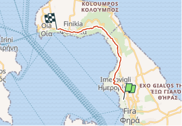

Length
9.2 km

Max alt
355 m

Uphill gradient
294 m
Km-Effort
13.6 km

Min alt
112 m

Downhill gradient
431 m
Boucle
No
Creation date :
2023-08-25 05:51:30.627
Updated on :
2023-08-25 15:02:35.25
3h30
Difficulty : Easy

FREE GPS app for hiking
 SityTrail
IGN / Geographical institutes
SityTrail Plus
The world is yours!
About
Trail Walking of 9.2 km to be discovered at Aegean, Thira Regional Unit, Thira Municipal Unit. This trail is proposed by Timax31.
Photos


Positioning
Country:
Greece
Region :
Aegean
Department/Province :
Thira Regional Unit
Municipality :
Thira Municipal Unit
Location:
Unknown
Start:(Dec)
Start:(UTM)
359092 ; 4032087 (35S) N.
Comments